Showing posts with label Auvergne. Show all posts

Sunday 6 September 2015

The Auvergne (7)

For our last outing, we went back to Puy de Sancy, with two hopes.
One, we had been told that there were far fewer midges in the morning - if anything, we found the contrary, and some photos simply aren't worth keeping because it looks as if I had a dirty lens when in fact it's just clouds of midges.
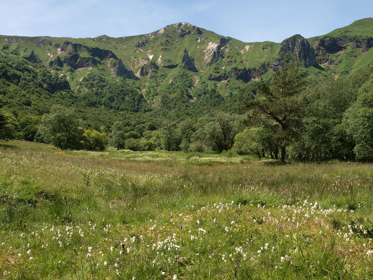
Two, we thought we would take the longer, easier descent so that I could enjoy the views more. Which I did, but because it was much less well way-marked than our first descent, we had trouble finding the start of the track and ended up going down underneath a ski-lift cable - short and sharp. Then we back-tracked up the main track, and also took a detour off it which gave us a wonderful view over the Chaudefour Valley which we had visited the previous day. And another plus was having the summit almost to ourselves for a while.

Bird song all the time everywhere - and no wonder, with such a feast of midges!

Our aim had been to follow the red right-hand track as you look at the map, but instead we cut off the little loop and went down right under the Teleski du Plateau. I think we managed to double back far enough to cover both the Dore and the Dogne. It's funny that it was the least well way-marked of all the outings we too. Even the previous day in the Chaudefour Valley where some of the trail was through forest, it would have been hard to go wrong.


view over the Chaudefour valley


Yes, it really was this steep, since at this stage we were following one of the pistes.


Montdore railway station

Saturday 5 September 2015

The Auvergne (6)

After the rather strenuous descent of Puy de Sancy, we opted for a more gentle walk in the Chaudefour Valley the next day. This is a green valley nestled in the folds of the mountain, full of lush pasture. The Auvergne has a big cheese industry, no surprise when there's so much green pasture for the cattle, sheep and goats.


wild orchid

Yellow Gentian


The rocky outcrops you can see here are The Cock's Crest on the left, then in the distance, The Devil's Horns, then in the foreground  -well, a direct translation is The Tooth of Spite or Malice, and then beyond the big tree is le Grand Dièdre.

Since it was near the end of term, there were a lot of school trips, and I think there were at least two groups in the reserve the day we were there. We were quite entertained listening to them, as we were behind one group for a while on our walk to this waterfall ( Cascade de la Biche). Their teacher hadn't checked how long the walk was, and turned back before the end.


Back in the central meadowland again.

You can see the Cascade de la Biche in the centre of this photo. I'm sure it must be quite spectacular when the snow starts melting.

Source St. Anne, a mineral water spring
I wished I had had an extra bottle with me, to bring some home. It was intensely metallic to taste, and judging by the red of the rocks around, probably has a very high iron content.


Typical cow bell (clarine)

I took a short video with the sound of the cow bells. Sheep wear them too, and from our tent, we could often hear the gentle tinkle of them as a flock of sheep were on the mountain slope across from the campsite. Apologies for the noise from the camera zoom.


Friday 4 September 2015

The Auvergne (5)

Our next outing was to Puy de Sancy, which wasn't far from Chambon - over the mountain pass, down into Montdore and up to the car-park for the cable car station. At 1886 metres (6200 feet), Puy de Sancy is the highest mountain in the Massif Central, part of an extinct stratovolcano.  4 minutes ascent  from the car park in the cable car brings you up a further 455 metres, leaving the final ascent to be made up 846 wooden steps, to protect the mountain. It's still a pretty steep climb, some of it is almost like a ladder. From the top you have a panoramic view in every direction - we even caught a brief glimpse of Mont Blanc in the distance.


view from the upper cable car station

This photo is actually from our second climb. I've inserted here because you can see the trail we took as our descent for the first expedition ; it runs to the left below a viewing point, and then along the ridges of the craters until it's time start the descent - or continue even further.


After descending from the peak, we took the turn towards the left at the Pas de l'Ane, and then at the next junction we took the right path, along the Val de Courre. I can't remember the distance; unfortunately I've deleted the photos I had on my phone which had details of the path we were following.


The summit, seen from the cable car station.

Looking down over Montdore


One of the crater lakes, similar to Lac Pavin


Near the end, a last, easy part of the climb.


Looking up towards the upper cable car station


I don't have a good head for heights, so some of this wasn't easy for me, but it was still very enjoyable. However, for the difficult parts I couldn't take any photos, as I had to concentrate on just looking ahead of me, trying to ignore the sheer slopes on either side. Once we got to the easy part when we were climbing down the mountainside rather than scrambling along the crater ridges, it was much easier and I was able to enjoy the scenery and wildlife. Again we saw a lot of birds of prey - near the peak we saw a raven and a black kite, and some sort of eagle as well as many buzzards. 
Near the bottom, we could hear a really unusual call. At first I thought it was a bird, but it was so loud that we paused to look and look - and were rewarded with spotting this little marmot. I've added a video - there's a fair amount of wind noise, but you can hear his call and how it echoed around the valley. They are quite small, and he was a long way away, so it's only a for-the-record photo. C was able to see him through the smaller spotting scope which we had brought with us.


Sunday 30 August 2015

The Auvergne (4)

Most evenings we went for a walk around part of the lake - there was a trail through the forest from the back of the campsite, or we could walk along the road. There was a board-walk around the lake where necessary, and we really enjoyed the peaceful atmosphere there. You can see the busier, lake-side part of Chambon across the lake in these first photos. In the second one, you can see the mediaeval chateau de Murol, built in the 12th and 13th centuries.


Campsite weather vane.


View from the campsite